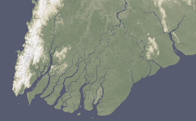
Rivers flow across the world's continents, picking up soil as they grow and moving it towards the ocean. When rivers pour into the sea, the dirt and rocks sink as fresh water disperses into salt. Over time, rich flat land, a delta, builds around the river mouth, usually forming a triangular shape. Deltas are rich agricultural land and provide easy access to water and water-based transportation. As a result, many of the world's largest deltas are heavily populated. Nearly half a billion people live on or near deltas, and that could be an increasingly serious problem, according to a paper published in Nature Geoscience. Most of the world's river deltas are sinking relative to sea level, putting millions at risk of severe flooding, researchers say, and human activity, such as dam-building, is the biggest reason. One of the deltas in danger is the Irrawaddy river delta in Burma,
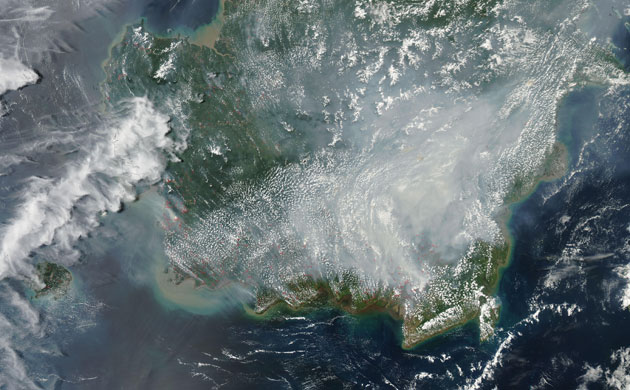
Thick smoke covered much of southern Borneo in September. The smoke was so dense that it hid the ground from view in these photo-like images. The smoke is clearly coming from fires burning in Kalimantan, the Indonesian half of the island of Borneo. In this tropical region, the widespread fires were almost certainly deliberately set to clear land. The places where the Modis satellite detected hot spots, probably fires, are marked in red
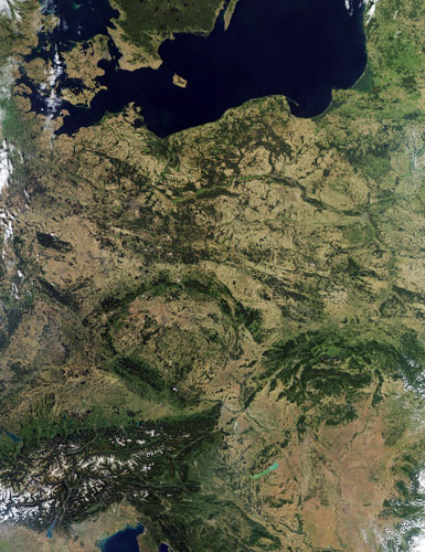
The darker hues of early autumn can be seen in this image of north central Europe. Dominating the top of the image are the black waters of the Baltic Sea. Sweden and Denmark are in the top-left corner. South of Denmark is Germany. Moving to the east is Poland, and Kaliningrad (part of Russia). Continuing to the north is Lithuania, and part of Latvia. Between Germany and Poland is the Czech Republic. Slovakia is south of Poland. Moving still further south is Austria (below the Czech Republic on the map). In the lower left corner of the image is Switzerland, northern Italy and the snow-covered Alps. The northern tip of the Adriatic Sea is at the bottom of the image. East of the Adriatic is Slovenia and Croatia. North of Croatia and south of Slovakia is Hungary. The large lake in this region is Lake Balaton in Hungary. It's the largest lake in Central Europe
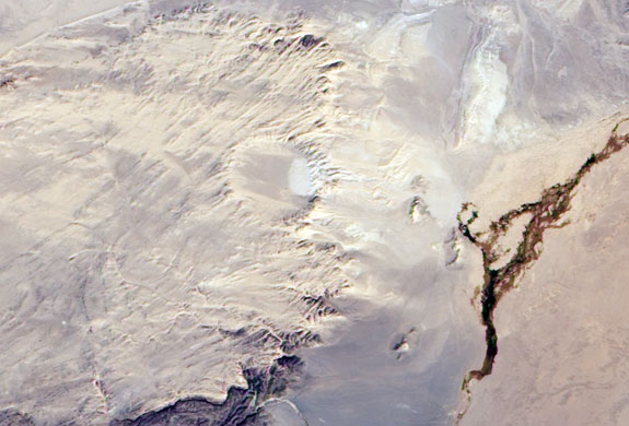
In south-eastern Mongolia, roughly halfway between Ulan Baatar and Beijing, lies Tabun Khara Obo, an ancient crater identified as a probable impact crater in 1976. Confirmation of this hypothesis did not come until 2008 however, when drilling at the site revealed rock features consistent with high-speed impacts such as those caused by meteorites. In this image, sunlight shines from the south-east, leaving the northern and western slopes in shadow. The crater's rim rises some 20-30m above the crater bottom. The crater occurs on a block of Proterzoic rock more than 600m years old, but the crater's age - which may be considerably younger - has not yet been identified. The dark, irregularly shaped area in the lower right corner of the image results from vegetation, likely occurring along a river channel. For the most part, the scene shows an earth-toned, arid landscape


0 comments:
Post a Comment