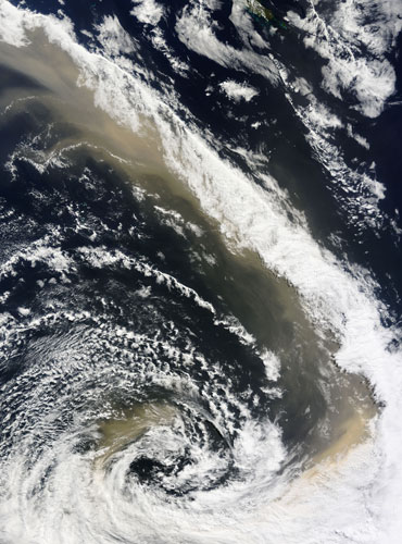
On 24 September, the dense dust that had covered eastern Australia the previous day blew south over the Tasman Sea towards New Zealand. The dust plume is still densely concentrated in this image, highlighting the strength of the winds. The lower half of New Caledonia is visible along the top edge of the image. Hidden by clouds, the northern shore of New Zealand's South Island is outlined in the lower right corner of the image
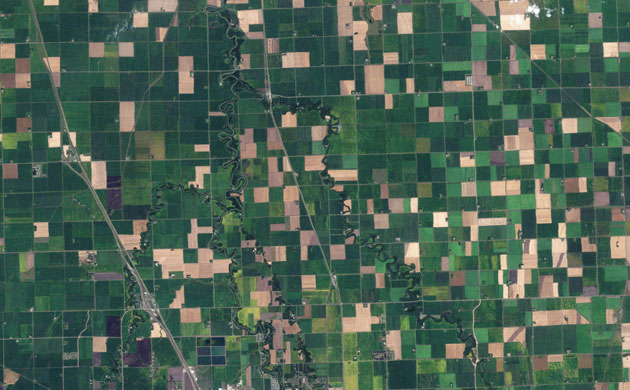
From space, north-west Minnesota looks like a patchwork quilt. Fields change hue with the season and with the alternating plots of organic wheat, soybeans, corn, alfalfa, flax, or hay
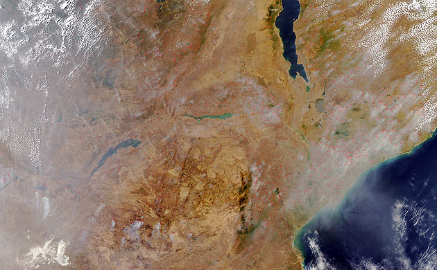
Fires burned in and around Mozambique in mid-September. At this time of year, near the end of Africa's dry season, the region glows with agricultural fires and wildfires. In this true-colour image, faint red outlines indicate hotspots where the Modis satellite detected unusually warm surface temperatures associated with fires
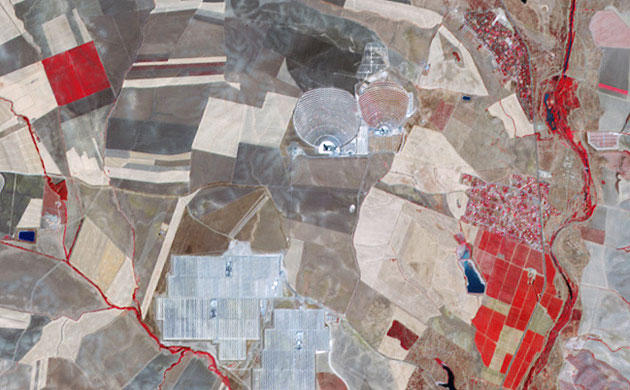
In a patchwork of agricultural fields outside Seville, Spain, two towers rise above the plain (at the centre of the top of the image). Nearby arrays of mirrors reflect light onto the towers, illuminating the water vapor and dust suspended in the air and creating visible beams. Within the towers, the thermal energy from the concentrated light creates steam, and the steam powers turbines to generate electricity. Known as PS10 and PS20, the mirror-tower networks are part of a larger project intended to meet the energy needs of some 180,000 homes roughly the energy needs of Seville by 2013, without greenhouse gas emissions
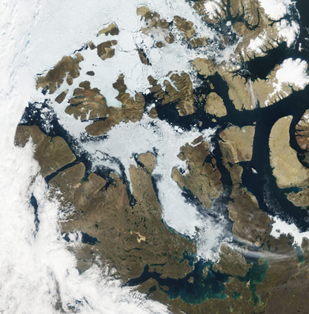
In late August 2009, ice clogged some but not all of the north-west passage, and snow had retreated from most of the islands in the Canadian Arctic archipelago. In this rare cloud-free view of the archipelago, although Parry Channel appears partially ice free, especially in the east, sea ice spans most of McClure Strait, blocking the northern, or preferred, route through the North-west passage. The southern route, however, which Roald Amundsen followed from 1903 to 1906, appears open. Snow-free land surfaces allow a view of the islands' topography
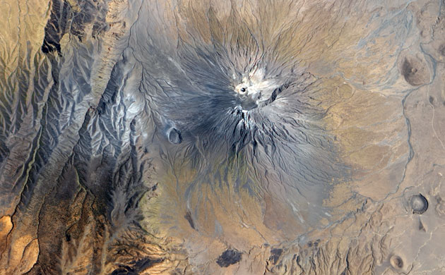
Ol Doinyo Lengai, in northern Tanzania is part of the volcanic system of the Great Rift valley in eastern Africa. It is the world’s only active carbonatite volcano. Unlike other volcanoes, which spew silica-rich basalts, Ol Doinyo Lengai erupts with an igneous rock rich in carbonates such as calcite and dolomite. Called natrocarbonatite, it is rich in sodium
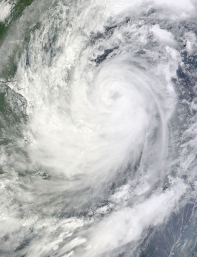
After causing devastating floods in the Philippines, tropical storm Ketsana continued its westward journey across the South China Sea, headed in the direction of Indochina. This image, captured on 28 September, shows the eye of the storm hovering over the island of Hainan, with clouds extending as far east as Cambodia and Laos


0 comments:
Post a Comment